
Meet the team: University of Queensland
July 22, 2019The University of Queensland team leverages field protocols with algorithms to produce maps for the Allen Coral Atlas. Get to know the team and their work.
The Mapping Team is based at University of Queensland’s Remote Sensing Research Centre (RSRC), in Australia. The Mapping Team leads the core, scientific mapping work of the Atlas: they make the maps! Taking data products from partner organizations Planet, ASU, and National Geographic, the team combines sophisticated cloud-computing computing techniques with over 75 years of collective mapping expertise to derive stunning and informative coral reef maps. After careful review, the maps are then passed back to Vulcan and National Geographic for display and dissemination to the coral reef and conservation community.
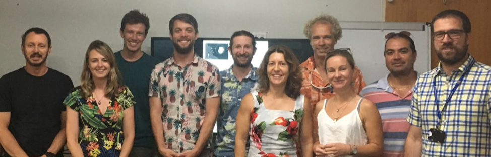
Meet the lab! From left to right: Prof Stuart Phinn, Dr Emma Kennedy, Dr Nick Murray, Dr Mitch Lyons, Dr Dan Harris. Dr Eva Kovacs, Dr Chris Roelfsema, Kat Markey, Meredith Roe, Dr Rodney Borrego-Acevedo
The Mapping Team includes a Cuban, a Solomon Islander, a Brit, a Dutchman, an Irishman and five Aussies — and are just as diverse in terms of their skillsets as their backgrounds. Prof. Stuart Phinn (world renowned earth observation and environmental change expert, and founding director of the RSRC) and Dr. Chris Roelfsema (senior lecturer, co-director of RSRC, with 20 years coral reef and seagrass mapping expertise) lead the UQ Mapping Team. Other members of the team are Dr. Emma Kennedy, Dr. Nick Murray, Dr. Mitch Lyons, Dr. Dan Harris. Dr. Eva Kovacs, Kat Markey, Meredith Roe, and Dr. Rodney Borrego-Acevedo.
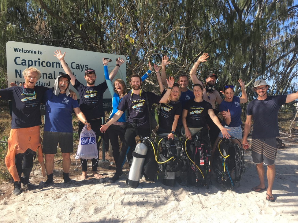
The one thing every team member shares is a passion for the ocean. They're all water lovers and everyone takes part in field expeditions to remote reefs to collect the vital field data to underpin the maps. As team leader Dr. Chris Roelfsema loves to tell his team, "For effective coral reef mapping you need to first 'smell' the reef!"
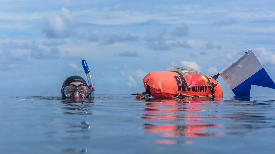
Dr Eva Kovacs tows a GPS on her dive. This means that every image of the reef she takes is geo-referenced so she can later map it.
What are you reading right now?
Eva: The Seven Deaths of Evelyn Hardcastle, Stuart Turton.
Meredith: Guardians of Marovo Lagoon, Edvard Hviding.
Stuart: Dark Emu by Bruce Pascoe. Must read book for all “Australians” and especially high schools and universities on the true extent of aboriginal civilization and especially environmental stewardship and food production.
Rodney: Learn JavaScript The Hard Way by Zed A. Shaw, to skill up in JS to code mapping solutions!
Chris: Flinders, The Man Who Mapped Australia by Rob Mundle. I love the part where it describes how Flinders navigated through the Great Barrier Reef, without maps, GPS or satellite imagery.
What’s a map that changed your life?
Eva: The course map for my first ultra-trail event — LOL!
Meredith: John Snow’s London cholera map. Very simple and clever and made a big difference to people’s lives.
Mitch: Not so much a map, but imagery — I’ve been in the Australian outback/desert many times, but there’s a certain beauty you can only appreciate about it from space.
Chris: The 2010 map of global coral reefs provided by UNEP. What it shows and what it is missing, specifically for the Great Barrier Reef.
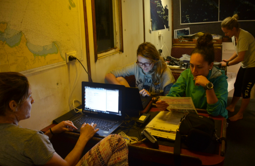
Working onboard the Kalinda: After a long day of diving, Dr Eva Kovacs, Dr Emma Kennedy, Kat Markey, and guest researcher Alex Ordonez work into the night to upload, process, and backup georeferenced image data in preparation for later analysis.
What are you up to when not working on the Allen Coral Atlas?
Emma: I’m a beekeeper! ☺ I also love to be outdoors – snowboarding, scuba-diving or mountain biking in the local forests with my partner-in-crime, Bella, a woofy german shepherd cross rescue dog.
Stuart: Teaching, trying to build Australia’s earth observation capabilities in industry and government, being in or on the ocean and with my family.
Rodney: Spending as much as possible time with family. Got a 8-years-old son who waits for me every afternoon to build slingshots, bow and arrows, kick soccer balls.
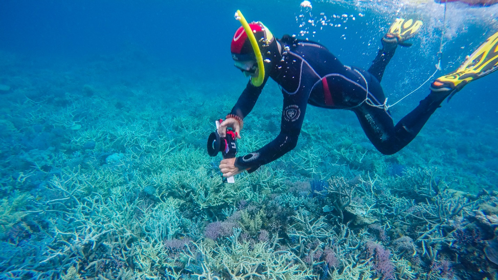
Project PI Dr Chris Roelfsema conducts a photo-transect in the Hardline Sector, one of the remotest areas of the Great Barrier Reef.
Where are you originally from? Tell us about it!
Eva: Straya! I see at least one kangaroo on most days.
Emma: LONDON! Aside from being the BEST CITY IN THE WORLD, London has more languages per unit area than any other place on earth. With 300 languages spoken on a daily basis, it’s the most linguistically diverse city in the world.
Meredith: I’m really from 3 places. From my Mum: Kiribati (it’s in all four hemispheres and may be gone soon due to climate change). From my Dad: Britain (somehow managed to shoot themselves in both feet with Brexit). Birth: Solomon Islands (in the coral triangle, lots of World War II wrecks so great for diving).
Mitch: On the outskirts of a rural area called Samford Valley, a little north west of Brisbane. It’s colloquially known as the “Home of the Powerful Owl," because it’s a hotspot for Powerful Owl breeding (biggest nocturnal bird in Australia).
Chris: Small farming village in Holland, where I did my first dives in lakes of 1-18 degrees Celsius, 3m visibility, and maybe two fish (if you are lucky). It took me 500 dives to dive on the closest coral reef, located 5,000 km away.
The UQ Mapping team (minus Meredith Roe). From left to right: Dr Chris Roelfsema, ReefCheck volunteer Doug Stetner, Dr Mitch Lyons, Dr Emma Kennedy, UQ lecturer Dr Dan Harris, Kat Markey, ReefCheck volunteer Josh Passenger, Dr Eva Kovacs, Dr Rodney Borrego, ReefCheck coordinator Jodi, Prof Stuart Phinn.
What’s some work you really admire right now?
Emma: Recently, I’ve been digging back through the coral reef classification literature and am pretty blown away by some of the coral reef mapping that was being done in the late 1800s to the early 1900s. It must have been difficult without satellites! Going back further in history, I’ve also started reading about Aboriginal star maps. Did you know many motorways in Australia follow the patterns of constellations? The new routes were built on traditional trails that follow the star maps. Amazing!
Meredith: Anything to do with astronomy.
Stuart: All of our PhD students in earth observation working on plants, soils, horticulture and reefs, and what they achieve day to day; it continues to always amaze me.
Rodney: Actually what has been done so far by the whole Allen Coral Atlas team. Great team effort to solve so many challenges. It’s great to see people coming from different disciplines getting together to do such an important groundwork with the common aim to save coral reefs.
View the mapping team's "backyard" — the Great Barrier Reef!
The Allen Coral Atlas is the first high resolution global map of the world’s coral reefs. The Atlas is built and maintained through a partnership between the University of Queensland, Planet, Arizona State University’s Center for Global Discovery and Conservation Science (GDCS), National Geographic Society, and Vulcan Inc.